Thursday, April 17, 2014

Climate Change Impacts and Mitigation

Regional Climate Projections

It is predicted that New Zealand will be warming during this century. This doesn't surprise me since the Earth isn't getting any colder. New Zealand is expected to experience higher daily temperatures and less extreme cold temperatures. Although the temperatures in South Island of New Zealand will not experience great changes in temperature, it will get noticably hotter. During the winter, South Island will also experience more precipitation (rain, snow etc) and an increase in wind speed. On the topic of wind, New Zealand's winds are influenced by a mixture of the Westerlies and New Zealand's many mountain terrains. Although the general temperature of New Zealand will increase the climate change will depend on Australia Monsoon, typhoons and how strong the mid-latitude westerlies will blow.


New Zealand mountains
Photo from here
All information stated above is from IPCC.


Specific Climate Changes

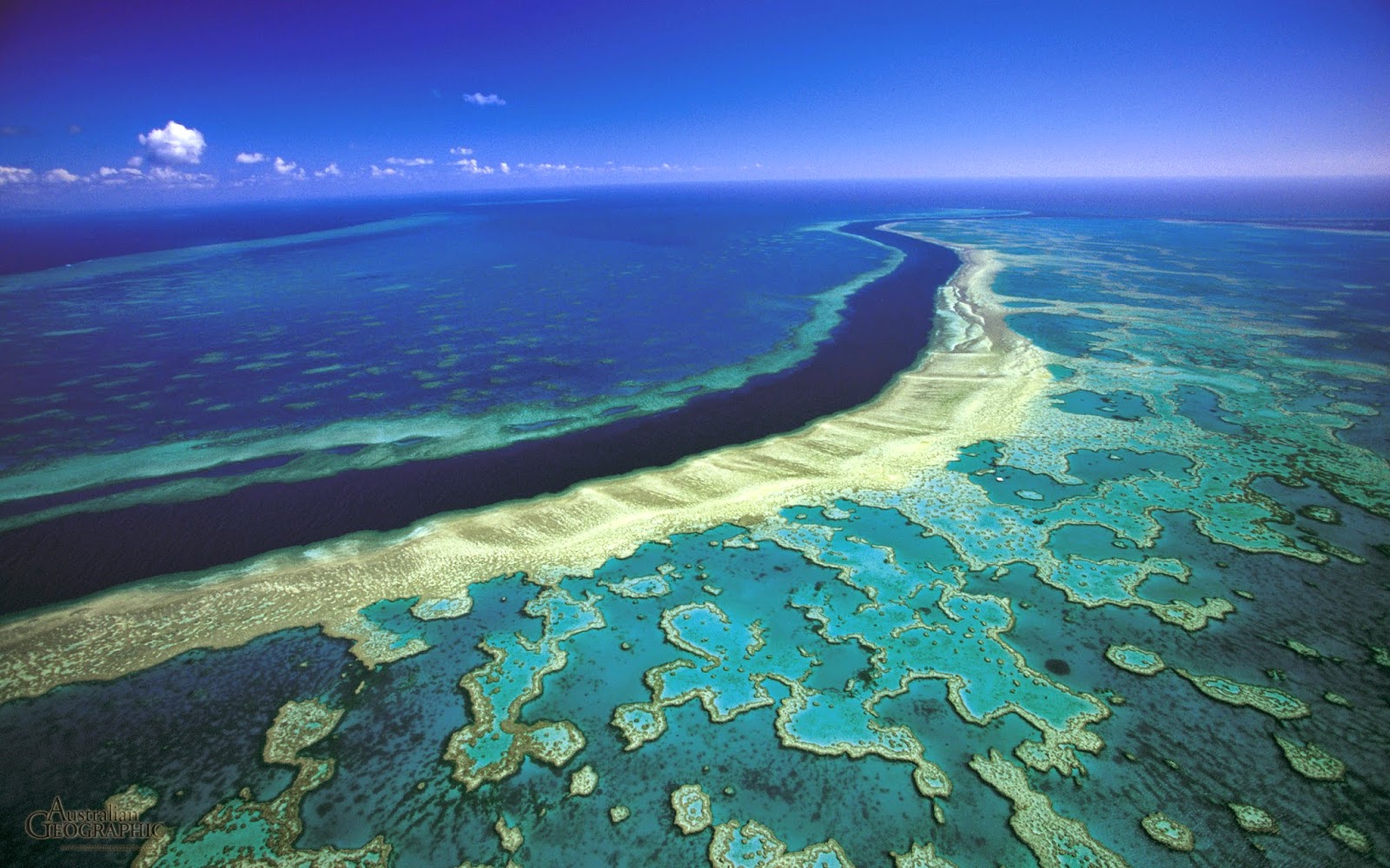
If traveling to New Zealand is on your bucket list, I suggest you go now. In the next 40 years, it seems like all hell is going to break loose and the beauty of New Zealand will collapse or something. According to IPCC there will be a substantial loss in biodiversity like the Great Barrier Reef and Queensland Wet Tropics (all near Australia),

Queensland Wet Tropics
photo from here


Great Barrier Reef
photo from here


Great Barrier Reef
Photo from here


Earth will weep with these beauties gone. Other damages include New Zealand's agriculture and forestry will start to diminish in the year 2030 because of fire and drought. Another shame because New Zealand is well known for the greenery and mountain ranges.

All information stated above is from IPCC.


Detailed Look at Future Climate

As I mentioned in the paragraph above, New Zealand is expected to experience hotter temperatures resulting in more fires and droughts. It get's worse. Floods and storm surges are expected to be not only violent but more frequent. Because of these rise of disasters, New Zealand does not seem prepared- mostly it's large infrastructures. Things like floods, damage to pipes, fire damages, heat waves etc will cause more deaths and blackouts. Unfortunately the vulnerability depends on how well humans are able to adapt.

All information stated above is from IPCC


Most Interesting Threat

There are four elements that exist on Earth - water, wind, earth and fire. With the expected increase in temperatures, fire and drought would probably be the most interesting threat. Fire can damage many of New Zealand's beauty including it's many forestry, mountain terrains and even agriculture. Many animals roam these terrains including sheep, cows, ox etc. If nature fires and droughts burn grassy terrain it doesn't only harm the grass life but also animals. Animals loose their homes and food.
Say good-bye to the lambs

photo from here


Data and Images


Regional Impact Map
Photo from here


With temperature rising, the South Island will experience more rainfall and the demand for water will increase because of droughts and fires decreasing the water supplies. Floods and typhoons will increase as well because of the warmer waters surrounding the North Island.


Friday, April 11, 2014

Severe Weather in New Zealand

TORNADOES

Tornado hitting Hokitika, New Zealand
Photo from here
Tornado (n) : a violent and destructive storm in which powerful winds move around a central point. (Webster)
Drawing from here

How cliche am I when the first thing that comes to my mind when the word tornado shows up, I think of Dorothy and Toto? Dorothy and Toto's home was situated back in the state of Kansas. In 2009 alone, 100 tornadoes ravaged Kansas (CRH). An average of 1,253 tornadoes hit the United States every year (NCDC) and moves from southwest to northeast. That is a lot compared to the amount New Zealand gets hit with. With an annual average of 7 reported tornadoes in New Zealand (Niwa), tornadoes rarely hit New Zealand.


But how do tornadoes form?

The only way to produce a tornado is if a thunderstorm is present.
                                     
Vortex tube formed
Photo from here


The first step in creating a tornado is when the westerly winds blows and winds from the southeast blows near the surface a rotating body of air is made. This is called a vortex tube. This occurs because as the altitude increases, the speed increases which is known as vertical wind shear.


Updraft lifts tube
Photo from here


This horizontal tube of air is then lifted off the ground from the middle by the thunderstorm's updraft creating an awkward "c" shape at first. Once the horizontal tube becomes a vertical standing tube it is called a mesocyclone.


Wall cloud and tornado formed
Photo from here


Finally the still spinning tube is developed in the updraft of the thunderstorm. In the picture to the right, a wall cloud is formed bellow the thunderstorm cloud which is the black part. Then a funnel cloud is lowered from the wall cloud. As soon as the funnel cloud touches the ground, it is now a tornado.


Global Map of Tornado Occurrences
Photo from here

New Zealand is located on the southern hemisphere. North Island is situated above the 180˚ mark. Then in between the 150E and 180 is the South Island of New Zealand. It's pretty tiny compared to United States and Australia. You may not be able to see it clearly but there are a few red dots (which mean tornadoes) on the land mass. New Zealand is located to the southwest of United States and it's tornado alley.


Photo from here
In the past 30 years, the amount of tornadoes has increased. After contemplating for a couple of minutes and only thinking of global warming; I think the numbers have increased because of global warming. Thunderstorms need a warmer surface temperature to rise and cold sinking air. I guess global warming could cause warmer than normal surface temperature.


Hurricane


Tropical Cyclone Ita
Photo from here
The picture above is category 5 Tropical Cyclone Ita, expecting to hit Queensland, Australia on friday 4/11/14. New Zealand is fairly close to Australia. Luckily, New Zealand does not get hit with tropical cyclones (hurricanes) often. It has an average of one cyclone per year (Niwa). United States on the other hand has an average of seven hurricanes per year (AOML).

Hurricane Formation Regions
Photo from here


You probably noticed that I used two terms for the natural disaster - tropical cyclone and hurricane. Countries in the Indian oceans like Australia use the term cyclone. Hurricanes are used in the Atlantic and East pacific Ocean (United Sates). Lastly the term Typhoon are used near the coast of China and Indonesia.

Hurricanes need three ingredients which are 1.) warm ocean waters that are greater that 80˚F, 2.) deep warm ocean water - at least 200 m deep (because if the upper part of the water was warm and the deeper part of the water is cold, it could kill the hurricane), 3.) Coriolis (what makes the hurricane spin) so greater than 5˚ N, S because there is no Coriolis at the equator.


Hurricane Path
Picture from here
From the picture above, hurricanes start off near the north Atlantic Ocean and Gulf of Mexico where there are higher chances of warm waters above 80˚F. Then with the push of westerlies and jet streams they travel up towards the U.S. where Florida gets hit often.


Wednesday, March 19, 2014

Daily Weather in New Zealand


Wellington, New Zealand
photo from here

Wellington - capital city of New Zealand and the second most populated city in New Zealand. Because New Zealand is located in the Southern Hemisphere it is experiencing with late summer/early autumn but temperatures in Wellington are already experiencing temperatures below 70ºF which is such a huge contrast compared to Hawaii! Here are five weather forecasts from the dates Thursday March 20 to Monday March 24.

photo from Wunderground


Starting with March 20th, the forecasted high is 68ºF and the forecasted low is 57ºF with a 0% chance of precipitation. The temperatures for the next few days after Wednesday seems like it has taken a small dip.
On Friday, March 21 with highs of 60ºF and low of 52ºF and a 0% chance of precipitation. Although it'll be a cold day (Hawaii standards) it seems like it'll be a sunny day as well! Saturday, March 22 is  forecasted with highs of 63ºF and a low of 53ª and 0% chance of precipitation.
March 23rd temperature high is forecasted to be 64ºF with a low of 53ºF and again, a 0% chance it will precipitate.
And lastly, Monday March 24 has temperature highs and lows of 64ºF and 57ºF respectively and a 10% chance of precipitation.

Scorching Bay in Wellington, New Zealand
Photo from here

To be honest I think New Zealand has the perfect weather. It's relatively cooler all year long but it doesn't get too cold in the winter that a girl from Hawaii would be freezing.


Satellite image of Wellington, New Zealand
Photo from her
From the satellite image above there are a lot of cold (blue) clouds on top of the low (grey) warm clouds. If you move around the map, Most of North Island and the northern part of South Island is covered with low warm grey clouds and cold blue clouds. This isn't a surprise since New Zealand's average rain fall is high which would probably explain the lush green mountains and forests. Near and in Wellington there are a lot of forest lands. But in The South Islands, there are more light brown desert or crop like places. South Island is known for it's country suburbs while North Island is much more populated with cities and buildings.  Wellington is fairly close to a harbor called Wellington Harbor which leads to the Cook Strait. It is also near by two lakes named Lake Wairarapa and and Lake Onoke.


Surface Analysis of New Zealand
Picture from Intellicast
The picture above shows a map of the surface analysis of New Zealand. There is a presence of a high pressure (which is indicated with the large blue "H") off onto the west side of North Island but no sign of a low pressure (which would be indicated with a large red "L"). Only three isobars are observed and are near New Zealand which is 1024 mb, 1020 mb which runs through the South Island and the southern tip (where the capital city: Wellington is located) of North Island, and of to the east of New Zealand is a 1024 mb isobar pressure.

Picture from Intellicast


There is a cold front that runs through the southern tip of the South Island that looks like the picture on the left.


Running through the East side of New Zealand are some brown dotted lines which are troughs. Throughs are showing us that the place has a relatively low atmospheric pressure or it can show outflow boundaries (which can be related to thunderstorms).


Thursday, February 27, 2014

Typical Weather and Tourism in New Zealand

Winter Solstice 


Auckland during the winter season
photo from here
Unlike what seems like the rest of the world, the Southern Hemisphere experiences it's seasons opposite of the Northern Hemisphere. Winter happens in June-July and summer happens during December-February. Because of this, the winter solstice for the Southern Hemisphere happens in the month of June. This year it will be happening on June 21, 2014! Of course for the northern hemisphere this is the day of the summer solstice (Time and Date). With that being said, the North Island experiences a maximum of  ~60 degrees Fahrenheit and a minimum of ~40 degrees Fahrenheit. The South Island on the other hand is generally more cooler with a maximum of ~53 degrees Fahrenheit and a minimum of ~33 degrees Fahrenheit (Toursim.net). With the cold weather it brings lots of rain and snow making it a post card scenery hot spot.
Personally I prefer colder climate more than warmer climate. Maybe it's because all my life I have only known of tropical climate and I have gotten sick of two seasons - summer and spring. At least in the winter time you can put on more clothes to stay warm while in the summer I can't go prancing around in my under garments.

picture from here

Summer Solstice 


Speaking of Summer:


Cathedral Cove, New Zealand. Located in the North Island
Picture from here

If you look hard enough you'll find that scene from Peter Pan where you find mermaids hidden somewhere combing their beautiful long hair. The summer solstice happens during the month of December for the Southern Hemisphere. Though I could not find highs and lows for each island, I found the high and low temperatures for major cities in the North and South Islands. The city of Aukland (most populated city in the North Island) has high temperatures of 71 degrees Fahrenheit and low temperatures of 59 degrees (Worldatlas.com) which really is not hot at all compared to Hawaii. It gets colder as you travel south. Dunedin is another city of New Zealand but lies in the South Islands. Dunedin's maximum temperature in December is a mere 67 degrees Fahrenheit and it's minimum is 50 degrees Fahrenheit. That's relatively colder than Hawaii's winter! (worldatlas.com) Though during this time, it is most likely to rain more than 50% of the time. One of the perks(?) of living near the equator.


Spring Equinox 

picture from here


Remember this guy? The ridiculously photogenic guy?


Not being bias here (maybe a little) but New Zealand is definitely ridiculously photogenic; especially during the spring time.


Lake Tekapo in the South Island, New Zealand
photo from here


"Pretty green pond" in New Zealand
Picture from here
Is it weird that I can imagine Highlanders roaming around on their horses in the last picture above? Spring Equinox happens in the month of September for the Southern Hemisphere. In the North Island, average maximum temperature stands at about 62 degrees Fahrenheit and minimum temperature is around 44 degrees Fahrenheit. The maximum temperature for the South Island is also 62 degrees Fahrenheit but the minimum temperature is a few degrees colder with 41 degrees Fahrenheit. The main precipitation New Zealand experiences during the Spring is rain. (Tourism.net)


Queenstown, New Zealand
Photo from here
And one last one for the road. Scenery reminds me of the many cherry blossom trees that bloom during the Spring in Japan.


Autumn Equinox


Queenstown, New Zealand during the Autumn
Photo from here


The Autumn Equinox falls in the month of March for New Zealand and for this year it will be March 21, 2014 (Time and Date) . Which means as of today (2/27) the spring/autumn equinox will be happening soon! You would think that with summer temperatures ranging form 60-70 degrees Fahrenheit that during the Autumn, temperatures would be relatively cooler but it's not. In Auckland (North Island) average maximum temperature is 72 degrees Fahrenheit and the minimum temperature is 58 degrees Fahrenheit during the month of March (World Weather Online). For Christchurch (South Islands) average maximum temperature goes up to 68 degrees Fahrenheit and the average minimum temperature is 52 degrees Fahrenheit (Holiday Weather). Rain will most likely to fall during this month.


Travel Agent Advice

Personally I prefer the colder weather than warmer weather but 90% of the people I ask which weather they prefer, they say warmer weather. So if you like warmer weathers then imagine Christmas on the beach. Instead of freezing in the polar vortex I recommend traveling to New Zealand during the summer months (December to February).


Picture from here

Summer in New Zealand does not get insanely hot (averages around 75 degrees Fahrenheit) so it's perfect to enjoy outdoor activities without the remnants of sweat on your shirt.
New Zealand is known for it's outdoor activities because of the various seasons that happen. One activity I would love to try is walking through Routeburn Track just outside of Queenstown, New Zealand.

Routeburn Track
Picture from here


Photo from here


This two to four day walk is like every outdoorsie person's dream. This 19 mile track is filled with horseback riding, walking across bridges, waterfalls and witnessing eye popping scenery. There are two main stops where you can stay over at huts or houses that are lined along the tracks so you'll have to pre-reserve. (Parks and Recreation)

If you're one of those people who likes the sea more then another activity you could do is swim with the dolphins and whale watch. Off Kaikoura, South Island has a rich habitat for sea life which includes the whole shebang; whales, dolphins and seabirds. (Telegraph.co)

Photo from here

Support the locals by taking a tour with Whale Watch Kaikoura which is a Maori owned dolphin and whale watching tour. (Telegraph.co)

Whale Watch Kaikoura
Photo from here

New Zealand would be a good place to go on vacation and not gain 50+ pounds. There's just so much outdoor activities that you can do and it accompany's peoples different taste.

Rain in New Zealand is like apple and apple pie- they go hand in hand. It is constantly raining in New Zealand that the only common weather hazard in New Zealand is heavy rainfall and floods. (Niwa.co.nz) New Zealand does experience cyclones and typhoons but they are on very rare occasions.


Photo form here


                            New Zealand - the place of endless activities and breathtaking scenery. 


Photo from here


See you in New Zealand!